
If I Ever Forget Thee, Remind Me- Renewal Plan for Jerusalem Center
I
avidly read the new renewal plan for the center of
Moreover,
the study is based on pre-Intifadah growth
predictions, and irrelevant and even harmful global examples like
And
as for the humor, the introduction made by the City Engineer speaks for itself:
"The city center has been the main goal of the city nobles for
years...." Dont take it
personally, my friend architect Uri Shetrit, but if
this is so, how have we gotten to where we are? If the city center is so vital,
why has so much effort been made to invest in the periphery? Does destroying
declared-for-conservation buildings, such as Schocken
Villa, or building a bridge that well relates to Calatrava but has nothing to do with
A bit of History
A
brief review of master plans from 1920 shows the citys development as a
byproduct of political acts, as opposed to an organized and planned process.
When
The
first urban plan was conceived by McLean in 1918 following the British invasion
of
In
1944 another plan was prepared by the British head of the division of public works, architect Henry Kendall, who was working
simultaneously on plans for Tel-Aviv, Yaffo, Tiberias,
Following
the declaration of the State of Israel, architect Heinz Row prepared the 1949
plan which aimed to maintain the only connection of
Completed in 1959, Master Plan no. 62 held few changes, apart from expanding the city center along the streets of Yaffo, Ben Yehuda and King George as well as zoning a large industrial area in Givat Shaul. However, the greatest change occurred in the master plan of 1968, following the Six-Day War. This plan aimed to reconnect the two sides of the city and the neighboring towns, and create a new reality. The political need to set territorial ownership, swiftly and on a large scale, caused the complete loss of the original urban scale. The plan defined a broad CBD, beginning adjacent to the old city, along the eastern section of Yaffo St., but also greatly expanding towards the north and east, to include "no mans land" that had been abandoned during the twenty years when the city was divided. The chaotic transportation plan that was implemented necessitated a demolition-construction approach that meanwhile damaged the delicate urban fiber of the city center. The plan called for the development of business and industrial areas in the periphery - adjacent to the Atarot airfield north of the city, and the Malcha area to its south, an area that has rapidly developed mainly since the construction of the Malcha mall in the 1990s.
From this point, the abandonment of the city center was just a matter of time. The planning chaos created transportation problems that further escalated the flow to the suburbs. Industry moved to more accessible areas next to the new neighborhoods, and the center was abandoned, poor, desolate and miserable.
AT Present
Several
attempts to improve public space resulted in the Ben Yehuda
and Nachalat Shiva pedestrian streets, yet maintained
free vehicular access on adjacent streets. On some unremarkable traffic
junction on
However,
the plan that aims to incorporate "all means necessary to create an
attractive and vibrant city center", carries a great danger. There is
always a chance that the multi-system approach could end in success. But, since
the powers at play - city nobles and planners - are well known, there is a
better chance that the plan will only increase the chaos, if not bring about
the future demise, of the city center. Unlike other cities,
The plan to reinvigorate the city center and revive its centrality is welcome, yet there are overly ambitious and pretentious declarations that are dangerous. Instead of a "transportation revolution", improvement would suffice. Instead of substantial increase in building rights, increased professionalization of current building ethics, with a special emphasis on conservation, would do. The rest would eventually evolve, without the need for a planning "Viagra".
The problem
Relying
on private initiative, most of the development will entail the addition of
building rights and other "payments". The result can already be
foreseen - high rise buildings, demolition of the fragile fabric and finally
construction resembling that of
Many
of the urban assumptions upon which this plan is based can be easily negated.
In chapter two it is stated that "the topographical structure of the city
crumbles into distinct neighborhoods, because of the hilly dispersion and the
demographic seclusion." This might be true, but that is not the reason for
the rapid suburbanization and the migration of strong populations from the city
core, as well as the creation of a multi-nucleus city lacking a clear focus.
Apart from the topographical reason, the real reason (as stated previously) is
the politically planned expansion of the city that created secondary centers at
the cost of the historic core. Or: on the subject of culture and commerce the
plan states that "today, there is no cinema or theater or any performance
center in the urban core. All museums are dispersed and mutually
exclusive". Moreover, the noticeable accessibility problems stem from the
transport commissions refusal to realize that the more limitations it places
on drivers in the inner city, the more the entrance and exit to the center are
made impossible. And yes, Malcha mall was built
according to an approved zoning plan. Anyway, shopping malls are not a unique
problem to
For unknown reasons the plan insists on incorporating the west entrance (which deserves a separate plan) to the city center plan, and thus places great effort on emphasizing the linear development along Yaffo St. It is obvious that this linear development which occurred before the unification of the city in 67 stemmed from the fact that there was only one main entrance - that at the west of the city from the southern coastal plain of Israel. One can assume that the same process will eventually occur even without any plan, when the west entrance will once again be the only entrance to the city, and the center will somehow attach itself to it, lacking any other direction of growth.
Another mistake, with an added element of fear, is implied in the following phrase: "...the small, privately owned lots discourage new development". One should remember that the small private lots are the exact unique urban feature of the historical fabric, and also its saving grace. If the planners themselves realize that this unique urban fabric is what should be saved, and not the availability of new construction, then why not benefit from something that even Malcha mall cannot rival?
And
for dessert: in the old city of
The Plan outlines
First
addressed in the plan is the transportation problem, the largest challenge to
the city that "refuses to reunite". According to the guidelines (in
chapter 6), the city center will be closed off to vehicular traffic, and the
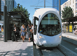
area will be served primarily by light rail, traveling along Yaffo St. to Yaffo- and Nablus Gate. I am sure that the transportation committee is
aware that many urban cities such as
Secondly
addressed is the issue of conservation, which is placed in the capable hands of
architect David Kroyanker, but surprisingly does not
provide much hope. One of the mute statements there suggests that: "it is
recommended to continue and conserve historical buildings, and not just for
financial gain (!!!!), but for cultural and educational purposes that gentrify
adjacent areas". Just one moment - shouldnt this be exactly the opposite?
The conservation plan allows private entrepreneurs increased building rights,
including a tripling of building height of historical buildings in the city
center. And if this is not enough, the conservation chapter suggests destroying
"ugly buildings". Who determines what is ugly??? Most of the
"ugly" buildings were built according to "innovative"
plans, while the "beautiful" buildings (at least in
In summation of this critique reference, it is perhaps best to condemn the plans erroneous and frequent use of the phrase "building fabric". If my memory doesnt deceive me (sometimes it does), the intention is to an act of strengthening the existing fabric, rather like a dentist who puts in fillings and even crowns here and there, yet leaves the original teeth in place. Unfortunately, many parts of this plan are rather reminiscent of plastic dentures.
And
a last remark: the plan which is made of 9 domains. reminds
me of an historical meeting held between the heads of the Israeli economy and
the economic expert of the time, Friedman, in order to discuss the galloping
inflation. After the problems had been presented to the expert, Israel Keisar, the secretary of the Histadrut
(workers union) got up and seriously suggested: "Maybe we should try a
working week of five days?" Friedman took a moment to think and answered
with even more seriousness: "Try to start off with three days". This
advice can also be advantageous to
And to the "soothing" aspect of the booklet, the plan intends to be (only) a guideline to planners and decision makers. If you wake up soon, the plan can still be stopped.
Planning team: Architect Arie Kutz (head), Amir Man,
Ami Shenar - Architects.
Building heritage: Architect David Kroyanker.

 בניית אתרי אינטרנט